



CLEVELAND —
5 Things to Know
- Additional heavy rain is possible Friday morning, starting first in the West and spreading east into CLE Metro, Snowbelt, Akron-Canton, and South Regions.
- Heavy rain is our greatest concern that could make the AM commute a slow go.
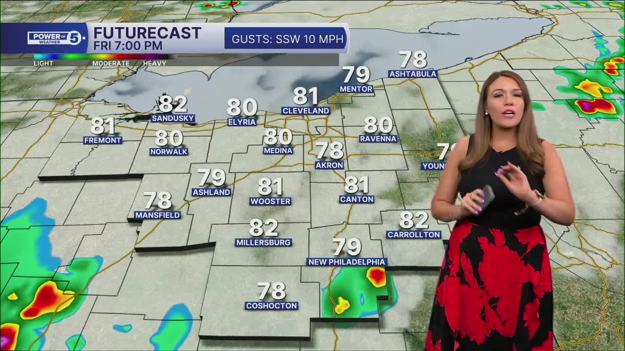
- Hit-and-miss storms are possible Friday afternoon & evening. These storms could bring isolated strong or severe storms, including heavy rain along with strong wind gusts and lightning.
- Saturday morning looks to have the highest chance of rain and storms for the weekend. Sunday will be mainly dry. An isolated shower will be possible in the West Region on Sunday.
- It remains warm and unsettled into early next week.
Power of 5 Region Spotlight:
Today's spotlight is on the West Region.
Heavy rain moved into the West Region late Thursday afternoon and evening. A quick 1 inch of rain fell across the region. These downpours will continue to slide east but should weaken over the next few hours. HOWEVER, additional heavy rainfall is possible overnight and Friday morning, and it looks to once again take aim at our west region early on Friday, before spreading east and south. The most widespread rain is expected Friday morning.
More Storms Ahead...
Storm chances increase Friday as more moisture moves into the area. The main concern looks to be heavy rain, with repeated downpours possible in some spots. Not everyone will see flooding issues, but any storm will be capable of producing a quick burst of rain that could lead to ponding on roads and reduced visibility. The most widespread rain is expected Friday morning, but a few more hit-and-miss storms are expected by the late afternoon and Friday. We will be watching for any strong or severe storms during that time. A few additional showers and storms are expected on Saturday, but there will be plenty of dry time. Only isolated showers for Sunday.
No Relief Yet...
If you're waiting for cooler air, you'll need a little more patience. The hot and humid pattern sticks around through the weekend and into early next week. Meaningful relief from the heat doesn't arrive until the middle of next week, when cooler air is expected to finally move in.
5-Day Forecast
Thursday: A few storms west. |High: 86°
Friday: Scattered rain with storms at times. |High: 82°
Saturday: Few showers/thunder. |High: 84°
Sunday: Mainly dry. Isolated t-showers. | High: 86º
Monday: Scattered t-showers. Toasty temps. | High: 87º
Learn the lingo: The Power of 5 Weather Team wants to get you your forecast closer to home. We have broken NEO into 5 separate and distinct regions. Find your region to get your hyper-local forecast!
- Cleveland Metro: Cuyahoga County. This region includes cities such as Cleveland, Parma, Westlake, Berea, Strongsville, Independence, Solon, Beachwood and Euclid.
- Snowbelt: Lake, Geauga and Ashtabula Counties. This includes cities such as Mentor, Geneva, Ashtabula, Bainbridge, Chardon, Burton and Orwell.
- Akron-Canton: Summit, Stark and Portage Counties. This region includes cities such as Akron, Canton, Hudson, Ravenna, Mantua, Alliance, and Canal Fulton.
- West Region: Lorain, Medina, Erie, Huron, Richland and Ashland Counties. This region includes cities such as Lorain, Wellington, Medina, Lodi, Ashland, Mansfield, Willard, and Sandusky.
- South Region: Wayne, Holmes, Tuscarawas, Carroll Counties. This region includes Wooster, Millersburg, New Philadelphia, Strasburg, Mineral City, Carrollton, and Newcomerstown
Want the latest Power of 5 weather team updates wherever you go? Download the News 5 App free now: Apple|Android
Click here to view our interactive radar.
Follow the News 5 Weather Team:
Trent Magill: Facebook & Twitter
Katie McGraw: Facebook & Twitter
Phil Sakal: Facebook & Twitter
Allan Nosoff: Facebook & Twitter
