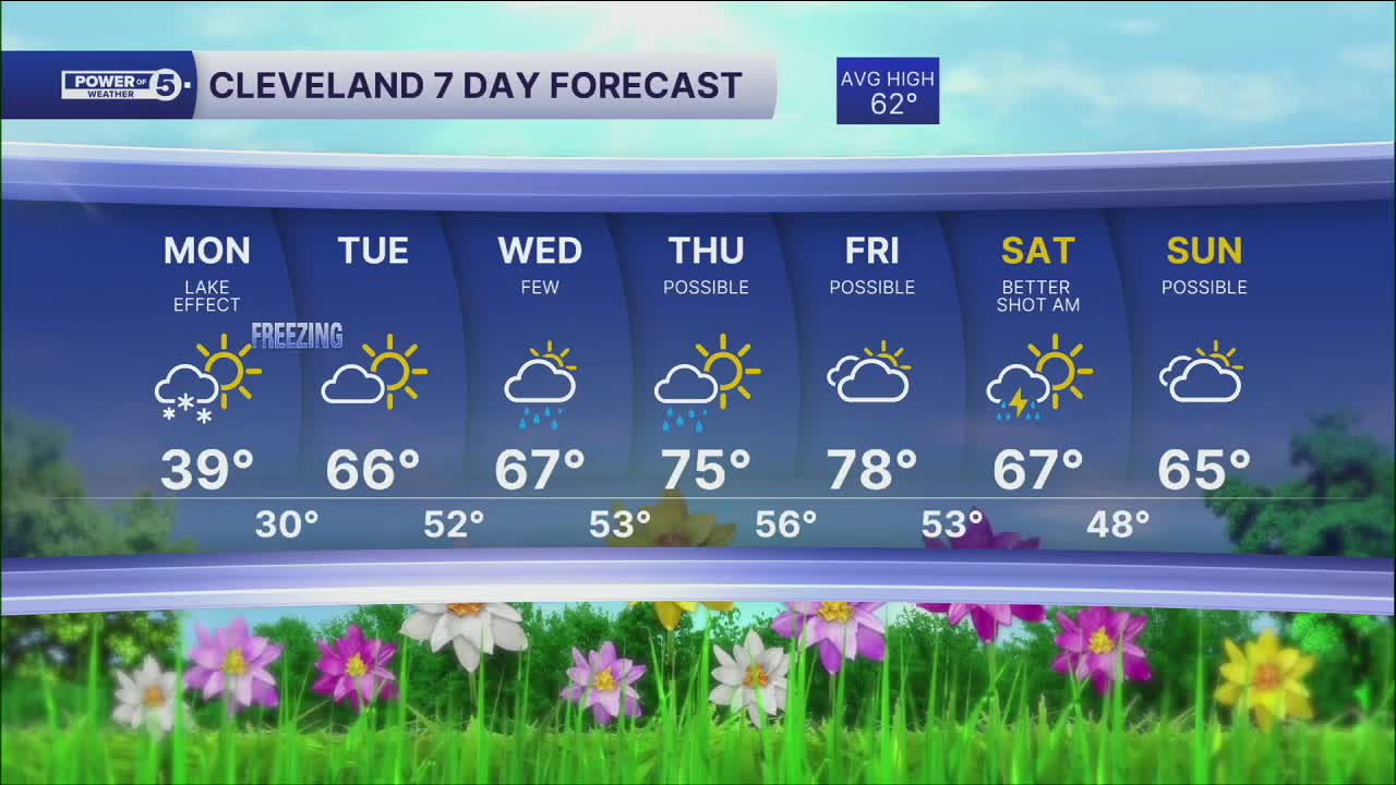


CLEVELAND — Say it ain't snow! Even colder weather arrives tonight, and with the cold, comes some snowflakes. It won't be a heavy or widespread snow, but a few locations could wake up to a coating on colder surfaces Monday morning. Actual lows will be near or below freezing, prompting freeze alerts.
A Freeze Warning has been issued for our entire viewing area from 11 p.m. this evening through 11 a.m. tomorrow. For more on the freeze, see this: Freeze Warning
Frost and or freeze conditions will not just be on Monday morning. There will be another hard freeze Tuesday morning, before a new warm-up takes shape late Tuesday through the end of the week.
DAILY FORECAST:
Monday: Cold with isolated rain/snowflakes. | High: 39º
Tuesday: More seasonable with sunshine. | High: 66º
Wednesday: Light rain possible. | High: 67º
Thursday: Morning shower possible, warmer. | High: 75º
Friday: Partly cloudy and warm. Storms at night. | High: 80º
Saturday: Storms possible, then turning colder. | High: 70º
Want the latest Power of 5 weather team updates wherever you go? Download the News 5 App free now: Apple|Android
Click here to view our interactive radar.
Follow the News 5 Weather Team:
Trent Magill: Facebook & Twitter
Katie McGraw: Facebook & Twitter
Phil Sakal: Facebook & Twitter
Allan Nosoff: Facebook & Twitter
