

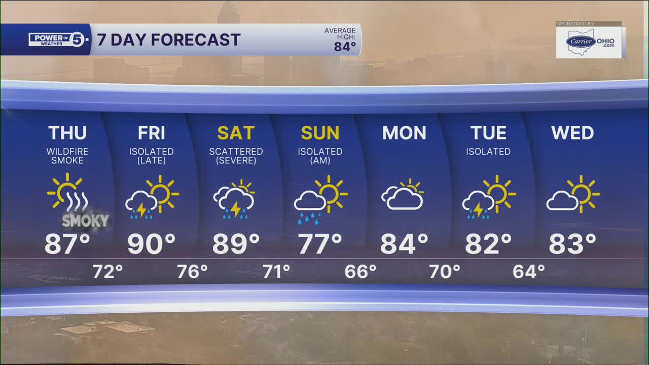


CLEVELAND — If you have breathing problems, take it easy on Thursday. It has been hazy, thanks to wildfire smoke in our atmosphere. Thus far, it has been high in the sky. But it will get lower to the ground by Thursday. This will result in hazardous air quality on Thursday and can negatively impact everyone. Be sure to take it easy!
Plus, the heat doesn't back off much on Thursday either. Highs stay in the upper 80s and lower 90s with another hot day across Northeast Ohio. Humidity is expected to drop throughout the afternoon, though, so it should not be *as* uncomfortable outside by Thursday afternoon and evening.
Changes arrive by the end of the week. A few thunderstorms are possible on Friday as the atmosphere becomes more active. Not everyone will see rain, but storm chances increase heading into the weekend. While the timing is not great, rain will help air quality.
There is an even better chance of storms on Saturday. The extra clouds and rain help knock temperatures back into the middle 80s. Storms could become strong or severe Saturday afternoon or evening. Be sure to stay weather aware! It does not look like it will rain the entire weekend. Only isolated chances for rain are expected on Sunday.
Looking ahead, summer finally settles into something closer to normal. Highs drop into the lower 80s next week, bringing a more comfortable and seasonable feel after several days of intense heat.
DAILY FORECAST:
Wednesday night: Super warm & muggy.| Low: 77º
Thursday: Partly cloudy. Still hot. Hazardous air quality.| High: 87º
Friday: Few storms. Hot and humid.| High: 89º
Saturday: Scattered storms. Could be strong. Muggy.| High: 85º
Sunday: Isolated t-storms. Cooler.| High: 80º
Want the latest Power of 5 weather team updates wherever you go? Download the News 5 App free now: Apple|Android
Click here to view our interactive radar.
Follow the News 5 Weather Team:
Trent Magill: Facebook & Twitter
Katie McGraw: Facebook & Twitter
Phil Sakal: Facebook & Twitter
Allan Nosoff: Facebook & Twitter
