



CLEVELAND —
A heat advisory has been issued for most of NEO on Wednesday. An air quality alert has also been issued for several counties.
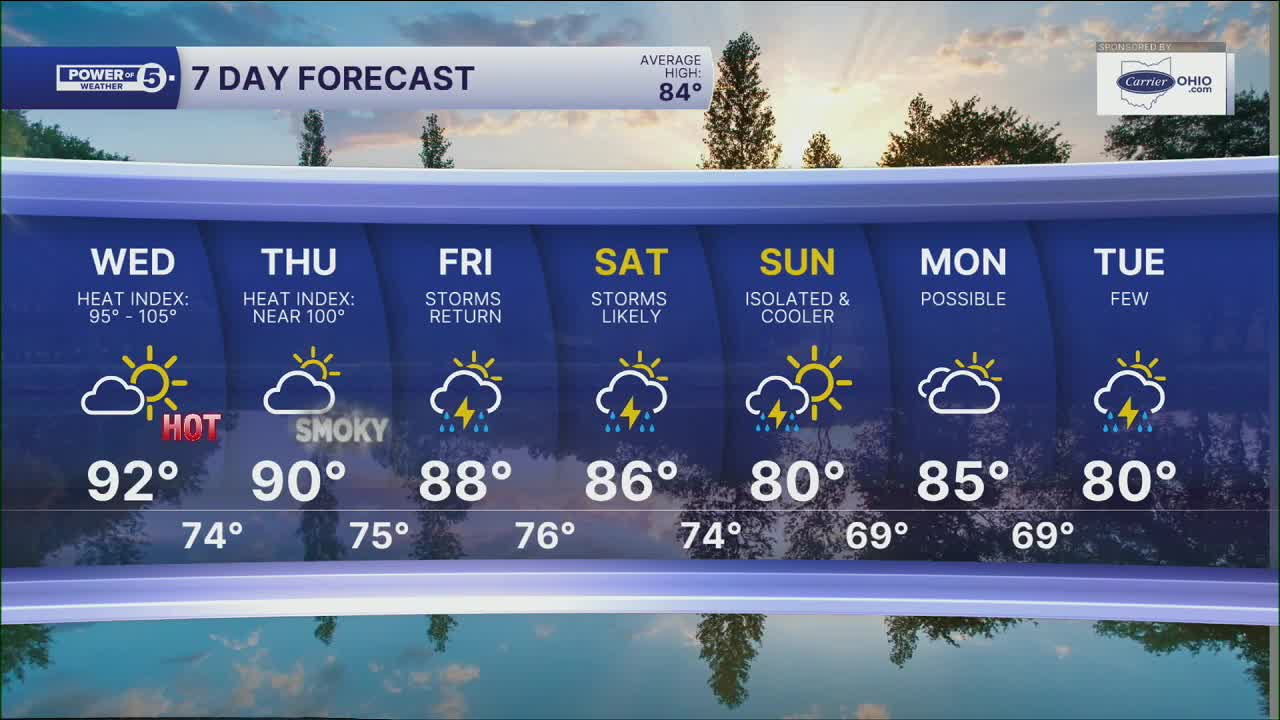
Wednesday will likely be the hottest day of the week with temperatures in the 90s for much of NEO. Heat indices will range from 95 degrees to 105 degrees once you factor in the humidity.
This isn't on the level of the late-June heat wave, but it's still hot enough to cause problems if you're outside for long. Heat Advisories are in effect, so take it seriously. The heat advisory will be in place from noon to 8 pm for almost every county, with the exception of Lake, Geauga, and Ashtabula.
The air quality will also be lower on Wednesday thanks to ground-level ozone. If you have breathing problems, take it easy. It has been hazy the last few days as well, thanks to wildfire smoke in our atmosphere. Thus far, it has been high in the sky. But it could potentially get lower to the ground by Thursday.
If you're headed outdoors, pace yourself. Drink water, find some shade when you can, and don't ignore the heat. It may not be a record breaker, but it'll still hit hard.
Our next shot at rain arrives Friday. A few thunderstorms are possible, but many places may not see much at all. The bigger change comes this weekend, most notably on Saturday. We will be monitoring the threat for any stronger storms. As storm chances increase, the temperatures will decrease a bit, but only back to more seasonable levels, and it will be less humid as well.
DAILY FORECAST:
Tuesday night: Mild and muggy.| Low: 73º
Wednesday: Hazy, hot, and humid. Feels like 95-105º.| High: 93º
Thursday: Partly cloudy. Hazy, hot, and humid.| High: 90º
Friday: Few storms. Hot and humid.| High: 90º
Saturday: Few storms possible. Muggy.| High: 87º
Want the latest Power of 5 weather team updates wherever you go? Download the News 5 App free now: Apple|Android
Click here to view our interactive radar.
Follow the News 5 Weather Team:
Trent Magill: Facebook & Twitter
Katie McGraw: Facebook & Twitter
Phil Sakal: Facebook & Twitter
Allan Nosoff: Facebook & Twitter
