


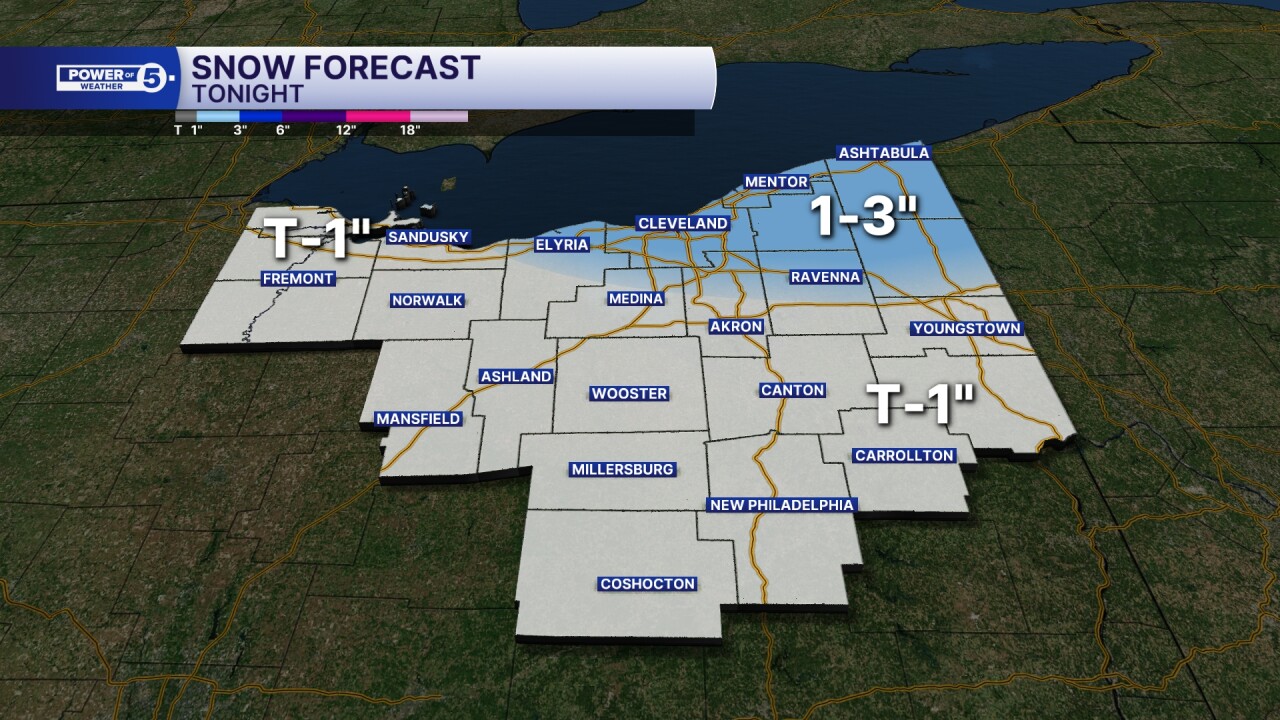
CLEVELAND — A quick shot of 1 to 2 inches of snow is likely across the snowbelt early Thursday, with an isolated 3-inch amount in isolated spots. It will be less than an inch elsewhere, and very little, if anything south and west. Early risers should be ready to wake up a bit earlier and plan on a few extra minutes of travel time with a quick burst of snow possible.
The blustery wind will remain even when the snow stops, and the temperatures will continue to drop. Temperatures will dip into the teens before sunset on Thursday. That means brutal cold for the High School State Championships in Canton.
Friday morning will be the coldest morning we've had since the middle of LAST winter. Single digits for most inland, feeling like below-zero. A forecast low of 11 degrees in Cleveland with a wind chill of about zero degrees.
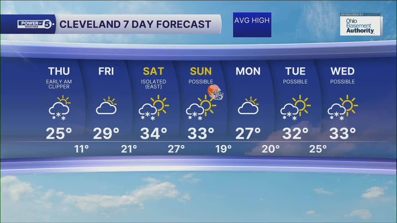
DAILY FORECAST:
Thursday: Clipper snow early, then cooling and breezy after. | High: 25º (and falling)
Friday: Frigid start and staying cold. | High: 29º
Saturday: Cold & breezy with isolated snow possible. | High: 32º
Sunday: Snow showers possible for the Browns game. | High: 33º
Monday: Cold and drier. | High: 29º
Want the latest Power of 5 weather team updates wherever you go? Download the News 5 App free now: Apple|Android
Click here to view our interactive radar.
Follow the News 5 Weather Team:
Trent Magill: Facebook & Twitter
Katie McGraw: Facebook & Twitter
Phil Sakal: Facebook & Twitter
Allan Nosoff: Facebook & Twitter
