


CLEVELAND — We are kicking off May with temperatures that are more like March in Northeast Ohio! We could even see a few wet flakes before the weekend is over...
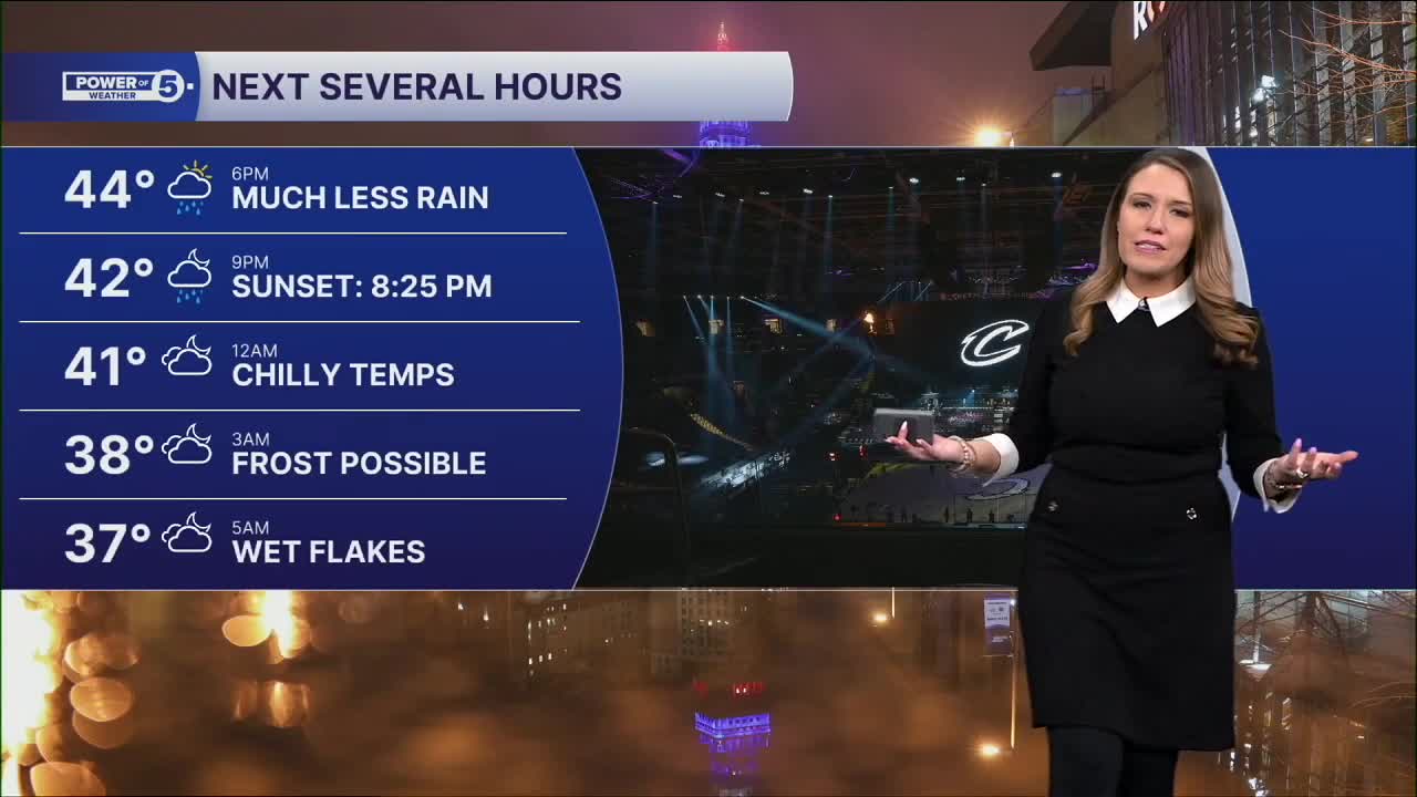
After a soggy Friday, showers have become more sporadic, but the chance of rain is not zero! In fact, with chilly digits and lingering moisture, a wintry mix is possible by Saturday morning. Wet flakes and minor slushy accumulations on the grass cannot be ruled out! This is thanks to morning lows dipping into the 30s. This also means frost is possible for most areas inland of Lake Erie. A frost advisory is in effect until 9 am for several communities across NEO.
Lake Erie itself is almost 50 degrees, which will keep frost very limited lakeside. We're still ahead of schedule if you're trying to plant your annuals. The rule in Northern Ohio is Memorial Day. We may get to bump that up a week or so this spring, but that means after May 15, which is still three weeks away. So, if you have any outdoor vulnerable plants, cover them or bring them inside the next few days.
Random showers will continue until late afternoon on Saturday, and temperatures remain way below average in the 40s. Frost will once again be possible Saturday night into Sunday morning.
After a chilly start, it will be getting warmer by Sunday afternoon with temperatures near 60 degrees. It will remain warm through Wednesday, but more rain is likely multiple days in that span, particularly on Tuesday and Wednesday. Wednesday's rain could be heavy and contain storms, but it is way too soon for specifics. Another cold shot is likely to follow to end next workweek.
DAILY FORECAST:
Saturday: Mostly cloudy. Showers possible. Wet flakes too! Cool. | High: 46º
Sunday: Mostly cloudy. Showers possible. Touch warmer. | High: 57º
Monday: Mostly cloudy. Few Showers possible. | High: 68º
Tuesday: Mostly cloudy. Few Showers possible. Cooler. | High: 60º
Want the latest Power of 5 weather team updates wherever you go? Download the News 5 App free now: Apple|Android
Click here to view our interactive radar.
Follow the News 5 Weather Team:
Trent Magill: Facebook & Twitter
Katie McGraw: Facebook & Twitter
Phil Sakal: Facebook & Twitter
Allan Nosoff: Facebook & Twitter
