


CLEVELAND — The weather pattern remains active with roller-coaster temperatures, so hang on!
Tuesday is mostly dry... and gusty... and MUCH warmer. By Tuesday evening and Tuesday night, strong storms will be sinking over Lake Erie toward our lakeshore communities. Tuesday night's storms are most likely in the northern half of our viewing area. These storms could also become strong or severe. Be sure to have a way to get warnings as you head to bed on Tuesday. For more information about the risk for severe weather, click this link.
Rain will continue on and off on Wednesday with falling temperatures. It will be getting colder fast on Wednesday morning from north to south. Most of the day will be chilly and wet with below-average temperatures. Thankfully, the cooldown is brief. We're back in the 60s and possibly 70s late week with more on-and-off rain chances.
DAILY FORECAST:
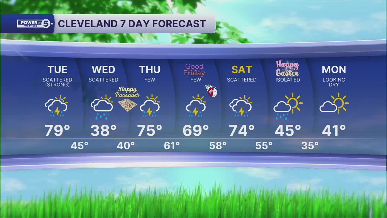
Tuesday: Partly cloudy, warm and humid. Evening Storms are likely. | High: 79º
Wednesday: Temperatures drop early with lingering chilly rain. | High: 50s —> 30s
Thursday: Another chance of showers. Seasonable temperatures. | High: 75°
Friday: Couple showers possible. Warmer. | High: 69°
Saturday: Rain returns. Best chance late. Warmer. | High: 74°
Want the latest Power of 5 weather team updates wherever you go? Download the News 5 App free now: Apple|Android
Click here to view our interactive radar.
Follow the News 5 Weather Team:
Trent Magill: Facebook & Twitter
Katie McGraw: Facebook & Twitter
Phil Sakal: Facebook & Twitter
Allan Nosoff: Facebook & Twitter
