


CLEVELAND — Temps are SOARING. We jumped ten degrees from Thursday to Friday, and we will keep that energy as we head into tonight and the weekend!
Temps will climb this weekend with highs in the mid 70s to the low 80s! The warmth will likely make everyone want to get outside this weekend, but we will have to listen for thunder and dodge on-and-off thunderstorms.
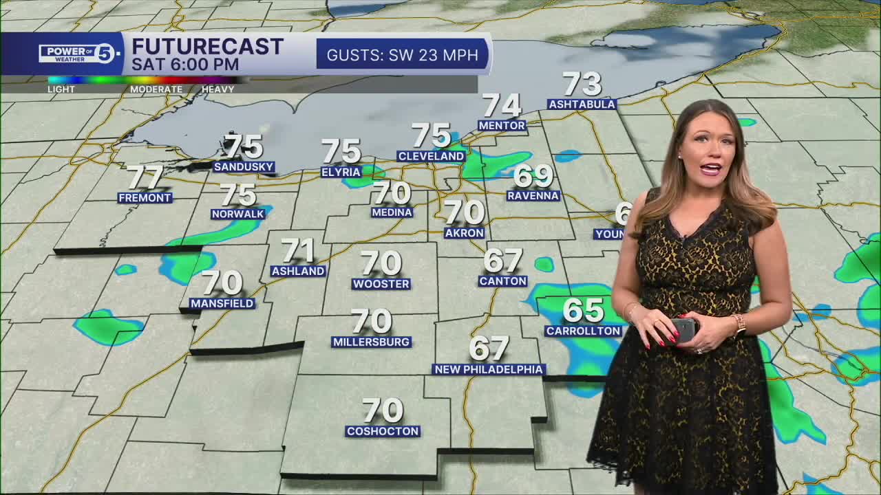
The best chance for storms looks to be on Saturday morning and early afternoon as a line of storms is expected to roll through at that time. We will be watching for any damaging storms, with the main threat being winds over 60 mph, heavy rain, and lightning.
It's an important forecast for the Cleveland Marathon on Sunday. Plan on a super sweaty start to the day with temperatures in the mid 60s for the start of the race and jumping fast through the morning. It will be sticky too!
A few lingering and spotty t-showers cannot be ruled out for the rest of the weekend, but there will be a lot more dry time on Sunday. The latest forecast is for only isolated t-showers on Sunday. Since the rain chance has dropped, the temperatures could go up! We may get into the 80s on Sunday!
Believe it or not, it should get EVEN warmer on Monday. Dare we say, "hot" for Monday?! Highs could be in the mid 80s! Much of the day looks dry as well, but we will have to watch a decaying line of storms Monday evening in our western communities. A better chance for storms holds off until Tuesday and Wednesday. These storms will be ahead of a cold front and usher in the return of cooler temperatures for the rest of the work week.
DAILY FORECAST:
Friday Night: Mild temps and mostly clear. | Low: 54º
Saturday: Warm & breezy with scattered storms. | High: 77º
Sunday: Isolated t-showers possible, very warm. | High: 80º
Monday: Heat building with a slim shot at thunder.| High: 85º
Tuesday: Storms expected. Could be strong. | High: 82º
Want the latest Power of 5 weather team updates wherever you go? Download the News 5 App free now: Apple|Android
Click here to view our interactive radar.
Follow the News 5 Weather Team:
Trent Magill: Facebook & Twitter
Katie McGraw: Facebook & Twitter
Phil Sakal: Facebook & Twitter
Allan Nosoff: Facebook & Twitter
