


CLEVELAND — After a series of thunderstorms that brought severe warnings and several tornado warnings in Northeast Ohio Wednesday evening, the storms have left our area after downing trees and power lines in Wayne County, among other areas of Northeast Ohio. They also provided some stunning skies that our viewers caught on camera.
Robert Chasing, @robsohioweather on Twitter, tweeted video of trees down in Shreve, as a possible tornado moved into Holmesville:
@NWSCLE @fox8news confirmed damage of Shreve, OH tornado as it moved into Holmesville. This was on Millersburg, RD between Force, RD and Munson, RD pic.twitter.com/wMWl5gu0sP
— Robert W Chasing 🌪 (@robsohioweather) July 21, 2022
The Wayne County Engineer's Office posted to Facebook at about 10 p.m. Wednesday that roads were closed between SR 226 and SR 83 due to downed trees and power lines. Wayne County Dispatch said they received multiple reports of trees down near Shreve.
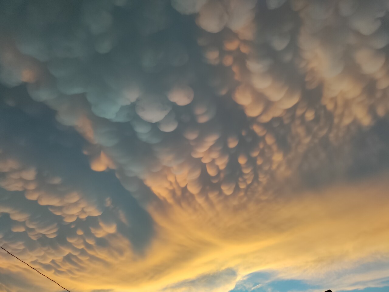
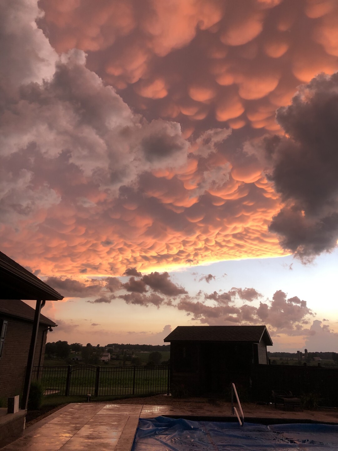
The storms also brought views of Mammatus clouds, striking pouch-like protrusions hanging from the undersides of thunderstorm clouds.


Tornado Warnings were issued for Holmes and Wayne Counties at about 8:54 p.m. after a severe thunderstorm capable of producing a tornado was located over Shreve, or 9 miles northwest of Millersburg, moving east at 30 mph. The warnings expired at 9:30 p.m.
A Tornado warning was in effect in Ashland and Richland counties from about 7:30 p.m. to 8:30 p.m.
Viewer Margaret Smith Arnold captured this video of clouds spinning in Mansfield while a tornado warning was in effect in the area.
Severe Thunderstorm Warnings were in effect across parts of Northeast Ohio throughout the evening.
The severe weather was largely out of the Northeast Ohio area as of 10 p.m. Wednesday, and Erik Drost captured a stunning image of the aftermath of the storms from Cleveland:

Chief Meteorologist Mark Johnson was tracking the severe weather live on Facebook Wednesday evening - watch him below:
News 5 will continue to report on damage left by the storms Wednesday, and will watch for NWS teams to survey the damage and confirm whether ot not a tornado touched down.
Power outages
Visit our Power Outage page to find links to see current power outages in Northeast Ohio and to report a power outage.
Traffic impacts
View our News 5 Traffic Map to see any road closures or delays due to the weather or crashes from the weather.
Send us photos, videos and reports of the weather
Please stay safe - do not put yourself in danger to get a photo or video of severe weather. You can email photos and short videos to pics@wews.com, and email storm reports and information to newsdesk@wews.com.
You can also submit information to us via the form on our Contact Us page here. For files larger than 10MB, please utilize a file-sharing service like DropBox or WeTransfer.
RELATED: Strong to severe storms possible on Wednesday
Want the latest Power of 5 weather team updates wherever you go? Download the News 5 App free now: Apple|Android
Download the StormShield app for weather alerts on your iOS and Android device: Apple|Android
Click here to view our interactive radar.
Read and watch the latest Power of 5 forecast here.
Follow the News 5 Weather Team:
Mark Johnson: Facebook & Twitter
Remeisha Shade: Facebook & Twitter
