


CLEVELAND — Are you ready? Another major winter storm looks like it's headed for Northeast Ohio as all of the ingredients are start to come together. The highest impacts will be felt Wednesday through early Friday with periods of heavy rain, sleet, freezing rain and snow all on the table, along with ice.
Chief Meteorologist Mark Johnson provides an update in the player below:
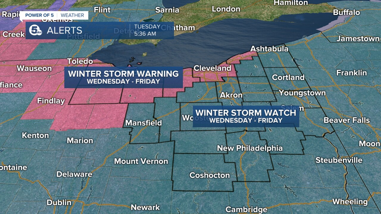
Winter storm watches and warning issued more than 24 hours in advance
In fact, the National Weather Service has already issued a Winter Storm Watches and Warnings for most of Northeast Ohio from Wednesday a.m. until 7 a.m. Friday. More info here.
How much snow?
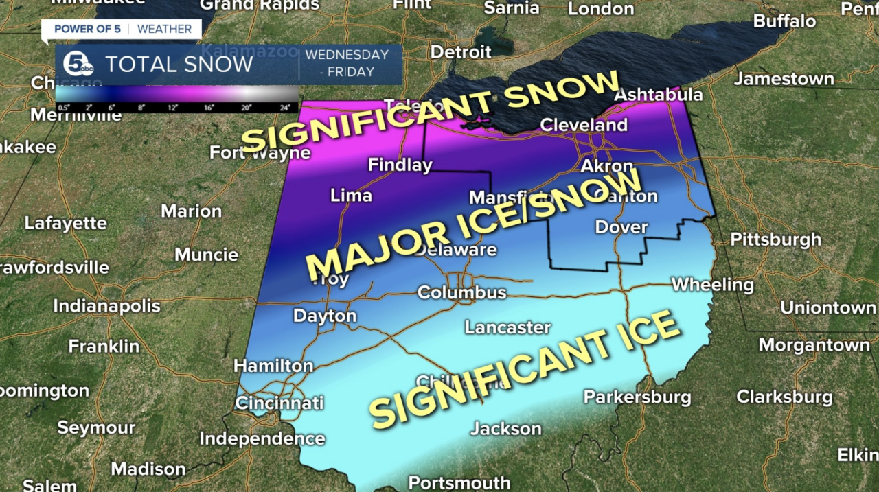
It appears that snow in excess of 10 inches will be a good bet during this time, which will create difficult travel conditions. Look for those winter storm watches to likely get expanded eastward later today or tonight. That means now is the time to prepare for what could be a significant winter storm with large impacts to travel mid-late week.

The timing
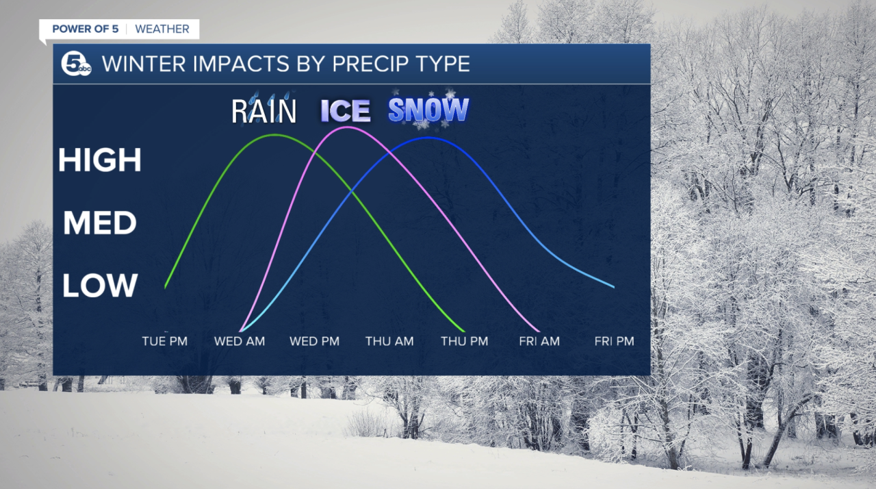
The storm will come in layers. Rain will bring high impacts likely the first part of Wednesday followed by major impacts from ice and snow late Wednesday through Thursday.
The winter storm should start as rain Wednesday a.m. with temperatures near 40. But temperatures will slide down all day Wednesday changing rain over to a wintry mix at times and eventually snow.

Thursday temps will be critical because the northern half of the area could end up getting heavy snow while the south and southeast parts of the area could get more significant icing. This ice/snow setup will be determined by the track of the system and just how fast colder air pours in.
Parking Bans
CLICK HERE to see a list of parking bans issued across Northeast Ohio.
How to stay informed
Remember to keep checking back with News 5 for the latest updates on the forecast, including additional watches and warnings. Our meteorologists will bring continuous coverage during Good Morning Cleveland, News 5 at Noon, News 5 at 4, News 5 at 5, News 5 at 6, and News 5 at 11 all week long. Severe weather alerts, including updates on road closures, power outages and school closings, are available on the News 5 app.
Reminder
We'll keep fine-tuning the forecast as more information is available to let you know the latest on potential ice and snow totals and storm strength and track.
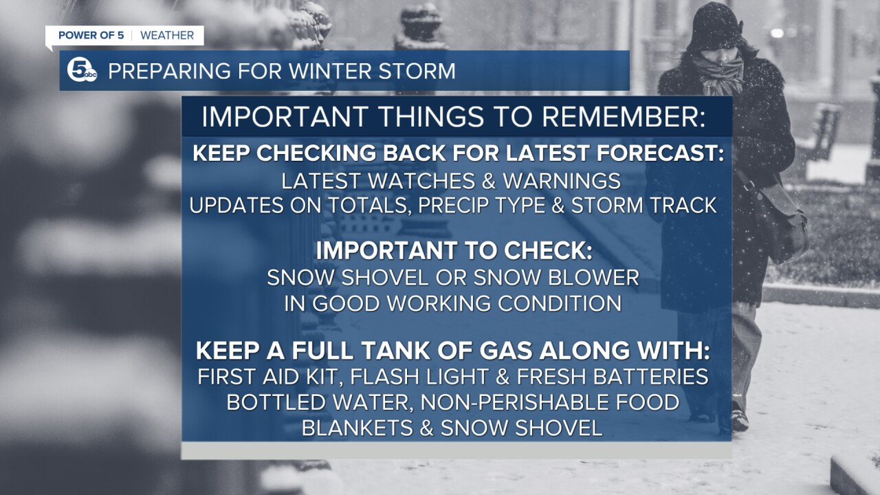
Be prepared
It's also important to make sure you have a snow shovel or snow blower in good working condition and ready to go when weather conditions go downhill.
Also, try to keep a full tank of gas in your car in case you get stranded along with a First Aid kit, flashlight and fresh batteries. Bottled water, non-perishable food, a blanket and a snow shovel would be a great idea to keep in the car as well.
Bottom line: be prepared for dangerous travel conditions developing Wednesday through Friday with this long duration winter storm taking shape.
Stay tuned with the Power of 5 Weather Team.
Want the latest Power of 5 weather team updates wherever you go? Download the News 5 App free now: Apple|Android
Download the StormShield app for weather alerts on your iOS and Android device: Apple|Android
Click here to view our interactive radar.
Read and watch the latest Power of 5 forecast here.
Follow the News 5 Weather Team:
Mark Johnson: Facebook & Twitter
Remeisha Shade: Facebook & Twitter
